
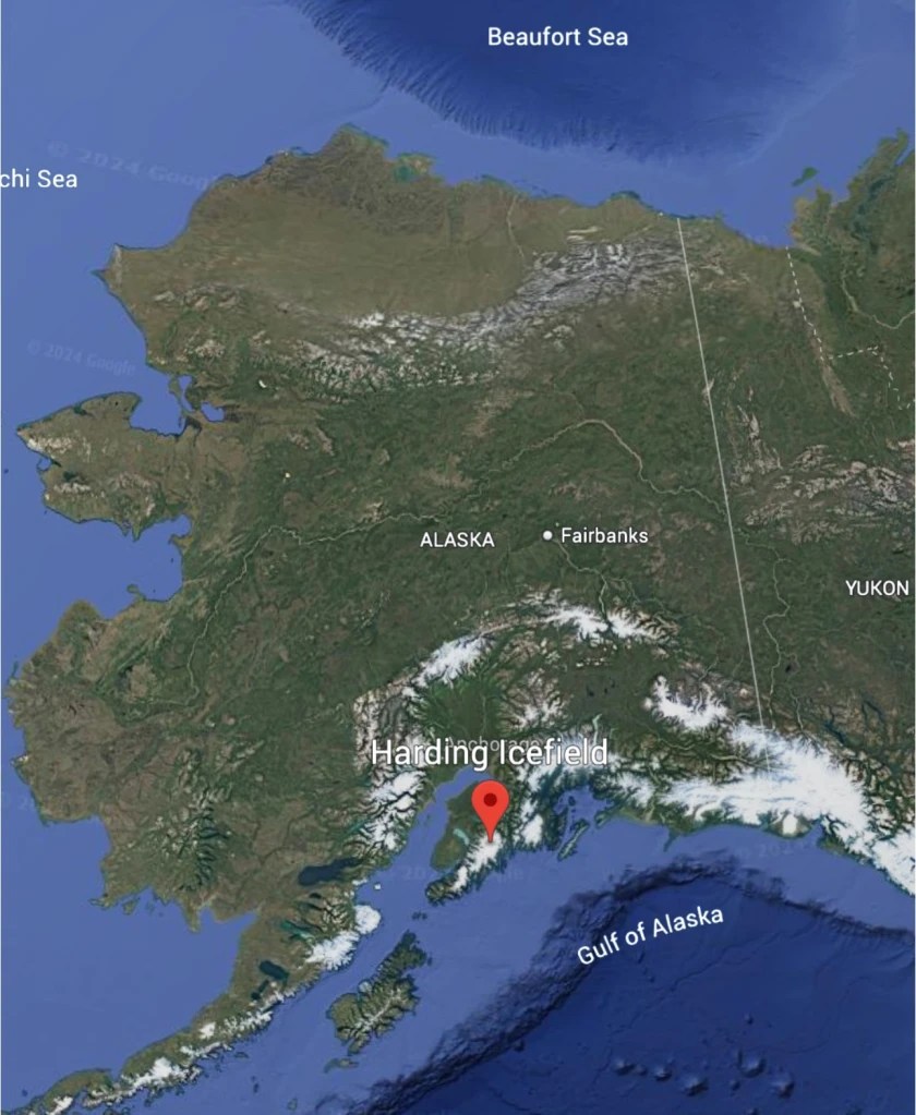
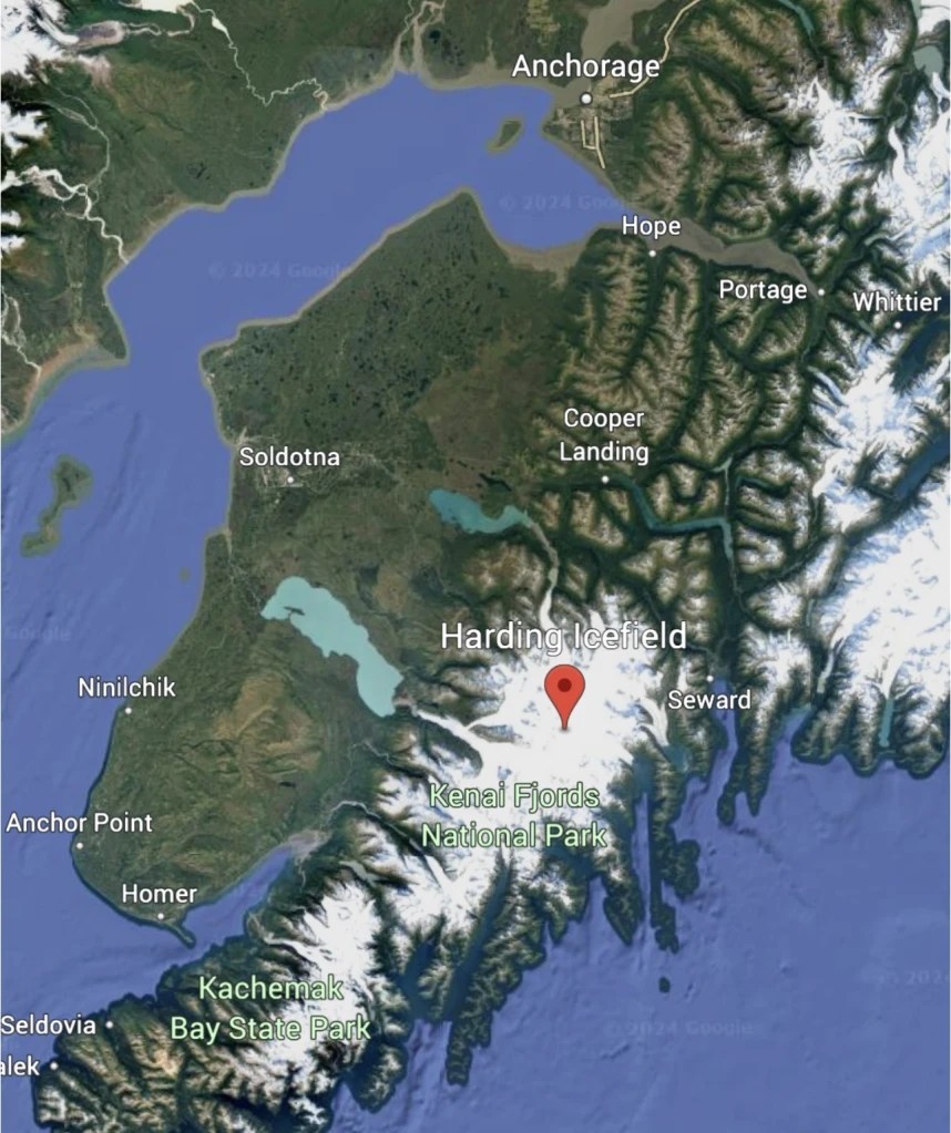
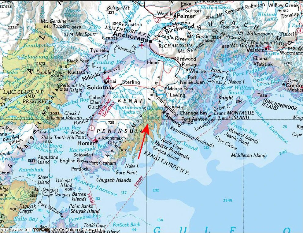
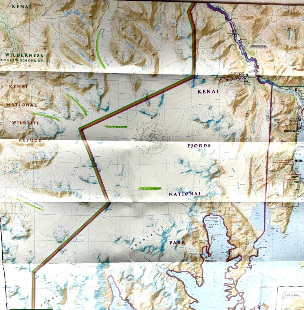
The Icefields are located in the Kenai Fjords National Park, Kenai Peninsula, Alaska
An icefield is a mass of interconnected alpine glaciers on top of a mountain with protruding summits. They are mostly in higher altitudes and colder climates where there is plenty of precipitation to foster their formation. Icefields are larger than alpine glaciers, but smaller than ice sheets and ice caps. Icefield topography is determined by surrounding land form shapes, while larger ice caps have their own forms overriding underlying shapes.
One of the main features of the Kenai Fjords National Park is the Harding Icefield. The Harding Icefield is the source of over 30 named glaciers that together with the icefield, cover over 700 square miles. It is one of only four remaining icefields in the United States – others are located in the coastal mountains of Alaska, British Columbia, and the Alaska Range.
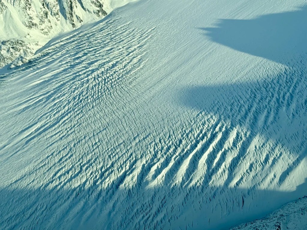
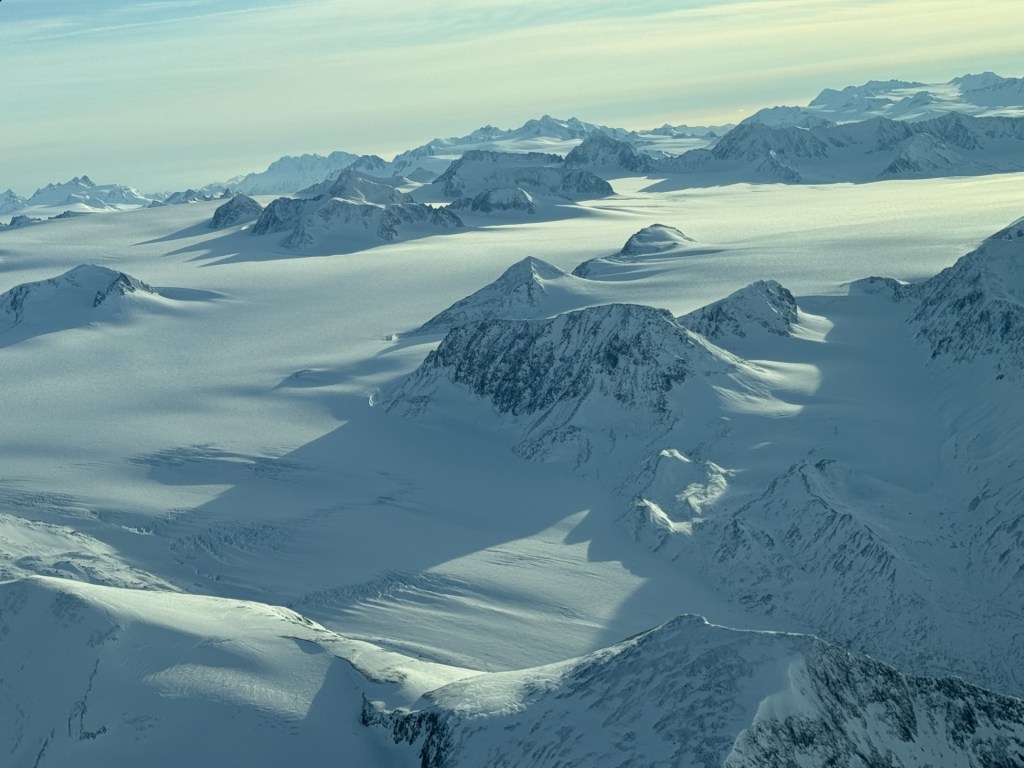
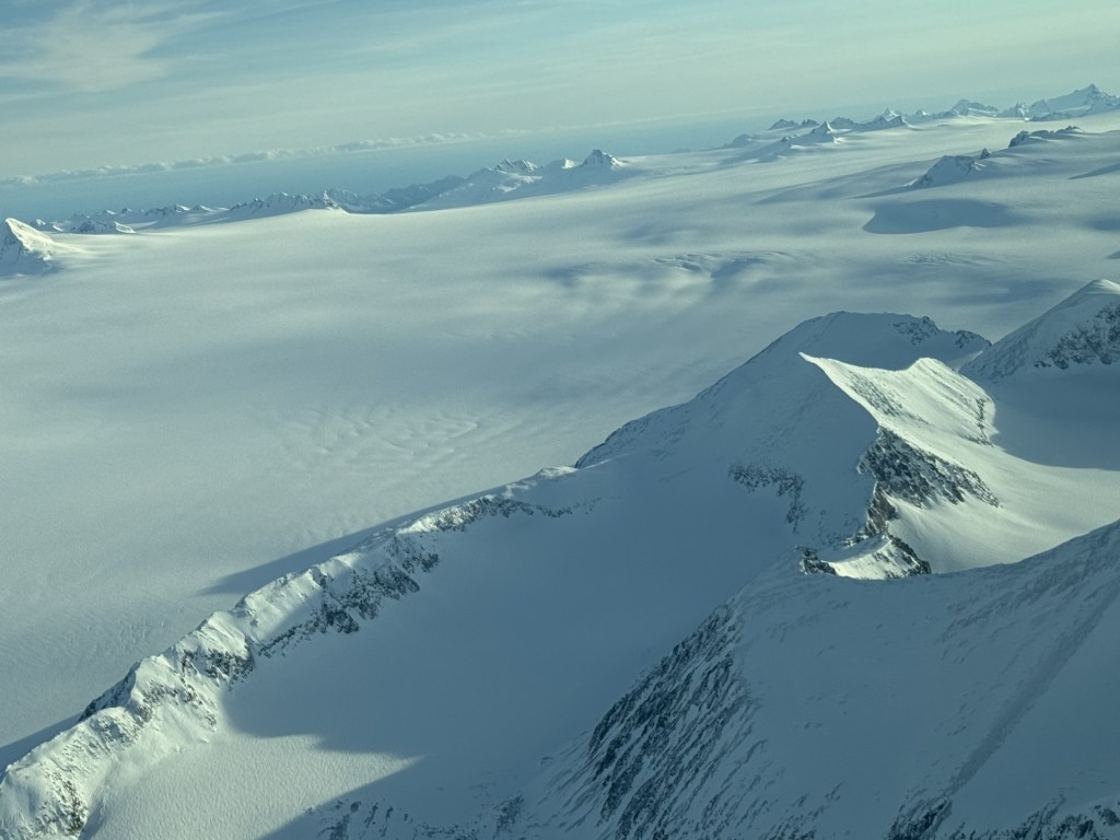
The Harding Icefield receives at least 400 inches of snow each year with winds at times exceeding 100 mph. The icefield is thousands of feet deep, with large crevasses (see pictures below) with a relatively flat surface interrupted by isolated mountain peaks or “nunataks”, an Eskimo term for “lonely peaks” – these are the higher peaks of the underlying mountain rock that protrude through the icefields.
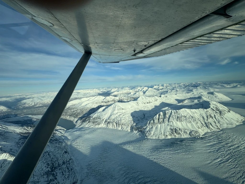
Regarding the name for “lonely peaks” above – lonely is far from what I felt flying high over this magnificent place! I felt somehow suspended between the highest point of earth (even though I was flying only about 6000’ MSL) and a higher place that was somewhat unearthly and with spiritual hints of grace and divinity, if you believe in that sort of thing. If not, then shift that into your favorite atmospheric terms and know that this was a feeling like none other that I have had aloft in the little Cessna 180 that was carrying me above this special place.
The Harding Icefield glaciers extend from the icecap roots to the ocean and surrounding waters (lakes) and lands of the Kenai peninsula. Although the icefield is over 700 square miles, if you were to count in its associated/connected glaciers that descend from the fields in all directions, it measures 1,100 square miles. Some of these named glaciers extending from the icefield to the ocean, lakes and surrounding lands are well known: Tustumena, Indian, Killey, Holgate, Pedersen, Skee, Bear, Lowell, Skilak, Exit, Aialik and McCarty glaciers to name a few.
Like other icefields, icecaps and ice sheets, the Harding Icefields are sensitive to climatic changes, responding to snowfall and temperature fluctuations over time. Additionally, the icefield also exerts influences over the local climate patterns of the Kenai peninsula – including wind directions, pressure dynamics and ultimately keeping surrounding land and waters cold.
Glacial geological records support that over the past 2.5 million years the earth has fluctuated between cooler and warmer conditions and encompasses at least four major glaciation periods with a dozen major glaciations occurring in the Pleistocene Epoch (the “Ice Age” that lasted from 2.58 million to 11,700 years ago and spanned our planet’s most recent period of repeated glaciations. Before this age, at the end of the preceding Pliocene, the previously isolated North and South American continents were joined [the Isthmus of Panama] and caused a faunal interchange between the two regions and their associated circulating oceanic patterns with glaciation onset in the Northern Hemisphere about 27 million years ago).
So I digress! Ha – but interesting to consider this place in these geological time frames and the associated faunal interchanges that have contributed to this special land.
Given the earths history of warm and cold fluctuations along with glacial deposit data in the scientific record, the cyclical changes in the earth’s orbit around the sun are a principle cause of the ice age and long term climatic changes of our planet (the Milankovitch theory). Interestingly, recent data supports significant short-term changes in Alaskan glaciers including those connected to the Harding Icefield. Using aerial and satellite imagery, a National Park Service (NPS) study measured a 3% reduction in the Harding Icefield over a 16 year period. Currently, the NPS has installed a monitor to collect data at 4,200 feet on a nunatak in the northeastern portion of the Harding Icefield – this weather station records temperature, wind velocity, relative humidity, precipitation, snow depth, and solar radiation on an hourly basis. You can see these date at the Western Region Climate Center’s website: http://www.wrcc.dri.edu/cgi-bin/awMAIN.pl?akAHAR
If you haven’t an airplane, or access to one, you can access the Harding Icefield via a steep, four mile trail leading from the Exit Glacier Ranger Station (just outside of Seward, AK) to the icefield’s edge – but ya better bring your climbing gear and ice pick. Although the Alutiiq and Dena’ina Natives had accessed the icefields historically, there is no record of anyone attempting to cross it until 1936 when Yule Kilcher, a young Swiss immigrant, attempted to make the trek across. Apparently he had seen the edge of the icefield from a steamer that dropped him off in Seward and needed to get to Homer. He was not willing to await another steamer, and decided to cross but with little luck as this was more of a trek than he appreciated. It was not until 1940 when two Alaskans (Eugene “Coho” Smith and Don Rising) made it across from Bear to Tustumena Lake. In 1980, legislation for Kenai Fjords National Park included protections for the Harding Icefield and its out-flowing glaciers. Today, during the warmth of the mid-summer season, many people climb the Harding Icefield Trail to see the ice firsthand. At the top, the view is unlike any other: mountain peaks enshrouded with ice stretch off into the distance.
Below you can see the large crevasses in the Killey glacier extending from the icefield. The plane circled over several times, but it remained really difficult for me to appreciate the depth of these even after several lower level passes – in feet or stories high. I am unable to find data regarding this, but it was impressive and I would be afraid to trek too close to this on foot. The ice was pristine and blue as can be the deeper it seemed to go. Amazing.
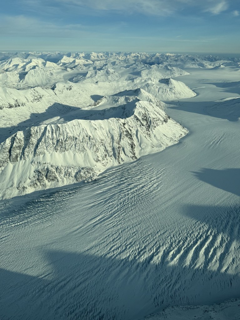
Photos below taken by yours truly from above the Harding Icefield between Skilak and Tustumena glaciers – over Killey and Indian glaciers – facing toward Bear Glacier near Resurrection Bay near Seward, Alaska.
Click on image below for video of the icefield looking across the field toward Bear Glacier

Leave a comment