
Icy Bay is by far one of my favorite places. It is breathtaking to see it for the first time, and once you can appreciate that it lies between sea level and 19K foot mountains with relatively few miles from the beach to the peaks, it becomes even more spectacular!
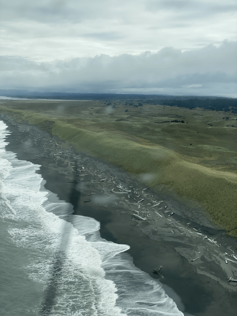
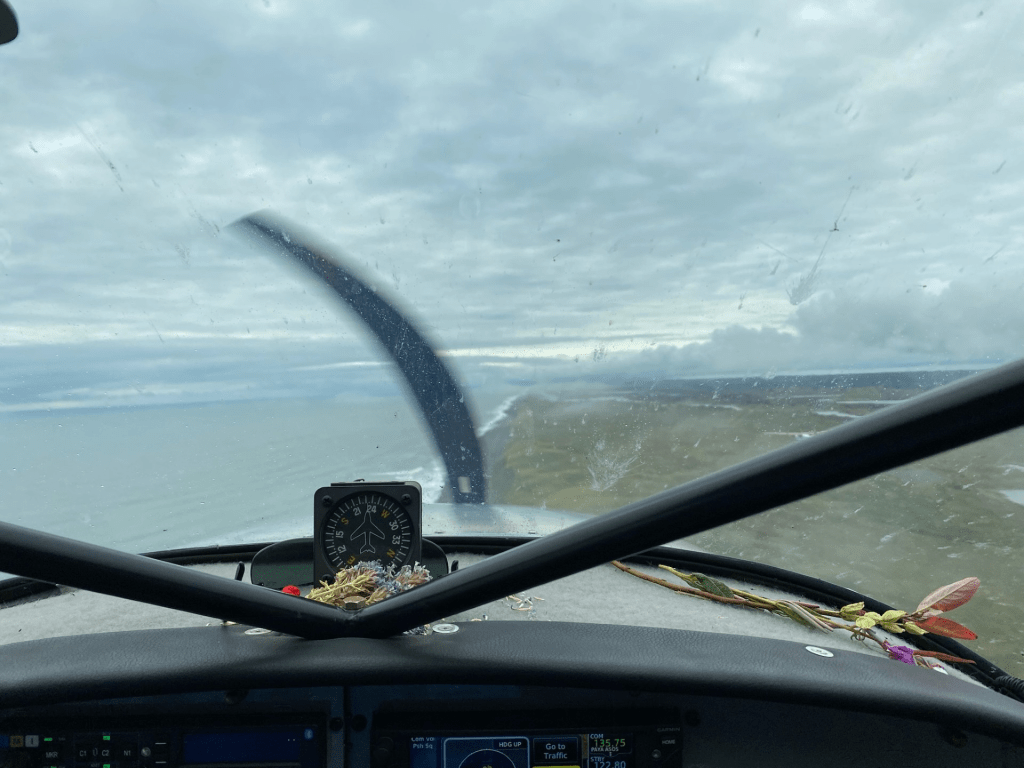
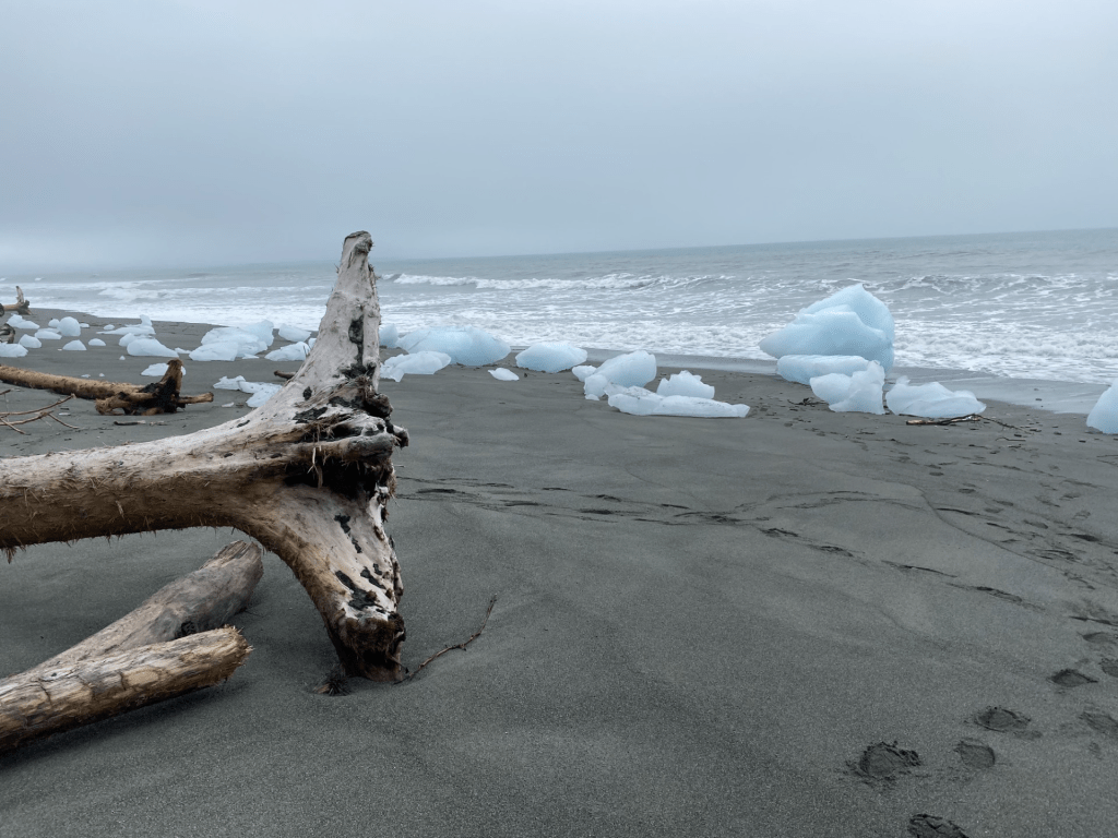
I got to this place quite by accident while flying from Juneau to Anchorage along the Pacific coast and was grounded in Yakutat for weather. We attempted to fly all the way back to Anchorage from Yakutat but landed at Icy Bay due to deteriorating weather conditions. We were only there a short time, but in that time period, I saw the most beautiful landscape ever and grizzly tracks that made my heart pound with excitement! There are icebergs that have calved from the glacier awash on the beach with large pieces of downed timber, logs, and trees standing just past the sand and surf.
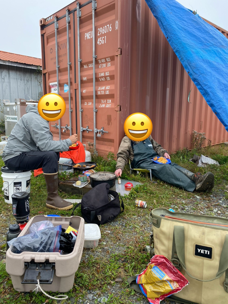
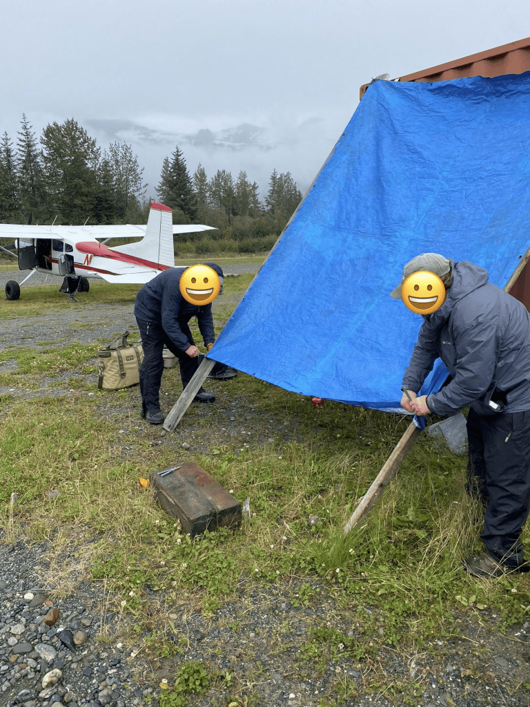
We spent time walking up to a nearby logging area and met a few of the young men working there and got a feel for what it is like for them to work in such a place. They were quite friendly and helpful with their wi-fi signal so we could re-assess the weather before attempting to fly out again. As we awaited more favorable flying conditions, we sat between the Icy Bay runway and the coastline in the cold rain (with our adequate gear so was quite pleasant) and enjoyed the views and the experience. Mac and cheese with chicken fingers made it even more fun! No plain ole Cliff Bars for us! We know how to camp!
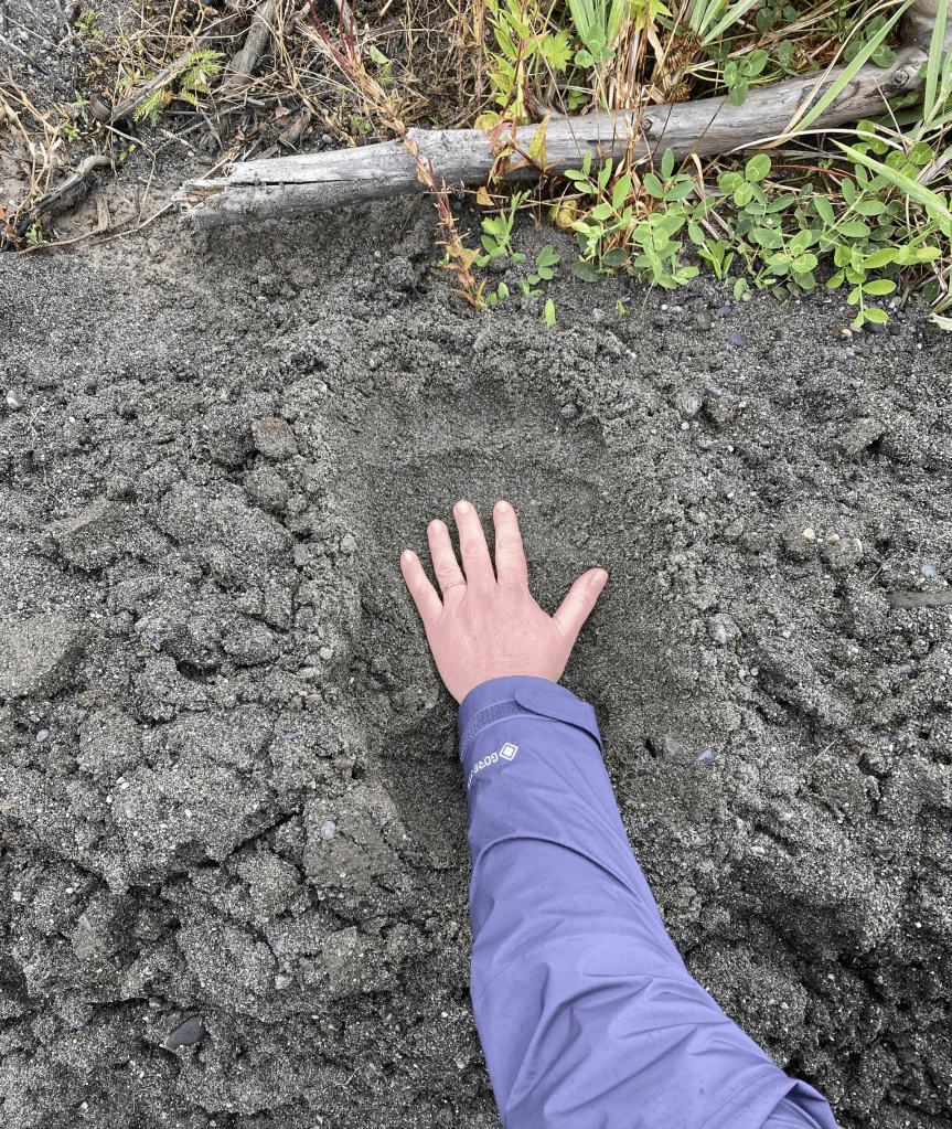
We walked the beach, followed the huge grizzly tracks (never saw the bear), and relaxed on the beach watching the tide roll and brilliant blue chunks of ice on the beach. I was in heaven.
About Icy Bay
Icy Bay was formed pretty recently (in geologic timeframes) – within the past 100 years – and is located in the Wrangell-St. Elias National Park and Preserve, and formed when the Yahtse, Guyot, and Tyndall Glaciers retreated rapidly. In the early 20th century, the entrance to Icy Bay was obstructed by a huge tidewater glacier – a glacier that flows from mountains into the sea with their main mechanism of ablation (ice loss) occurring via calving icebergs into the sea. This giant tidewater glacier calved icebergs into the Gulf of Alaska (an arm of the Pacific Ocean that curves from the Alaskan Peninsula and waters surrounding Kodiak Island, and southeast to the Alexander Archipelago), and a century-long glacial retreat has resulted in a multiarmed bay that is >30 miles long.

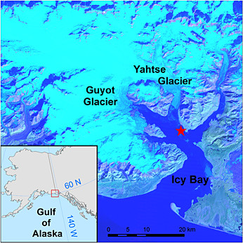
As shown in the map above of the bay, the waters are protected and surrounded by incredible scenery where wildlife abounds, making it an idea place for wildlife watching and sea kayaking. Like many beautiful places in Alaska, Icy Bay access is limited by bush planes and boats only.
The closest town is Yakutat which offers lodging; guided tours for fishing, beach combing, wildlife watching and kayaking; a restaurant with a bar; and beach camping. The airport is friendly, and we were greeted when we landed in the cold rain with warm chocolate chip cookies and nice people to help refuel the planes and tie down.
More interesting geologic history
On October 17, 2015, the western portion of a mountain of the Taan Fjord collapsed creating a mega-tsunami. This is different from a tsunami in that it is a very large wave resulting from the abrupt displacement of rock and debris into the water, whereas tsunamis are caused by underwater plate tectonics and earthquakes where the fall or rise of the sea floor creates the water displacement. Ordinary tsunamis result in shallow waves in deeper waters while dramatically increasing in height as they approach more shallow waters near land. This is a different mechanism from a mega-tsunami in that the waves of a mega-tsunami result from water displacement as described above; these can be from a landslide, volcanic eruption with significant land and debris displacement, and/or meteor impacts. Mega-tsunamis have extreme wave heights – sometimes hundreds of meters high!
The October 2015 mega-tsunami went undetected initially secondary to no one inhabiting that region at the time. It was eventually discovered via Columbia University in New York and registered as a 4.9 magnitude event. Later, scientists discovered that the landslide was comprised of approximately 181 million metric tons with a volume of rock nearing 76 million cubic meters. The event lasted less than 100 seconds and reaching speeds of 108 km/hour. The landslide eventually stopped at the foot on Tyndall glacier, but not before displacing another 100 million cubic meters of rock and debris from the fjord’s bottom. A portion of the debris crossed the 300 ft water depths at the head of the fjord before climbing another 344 feet and stopping at an elevation of 49 feet on the opposite shore. The wave was estimated to be about 40 feet tall upon its entrance into Icy Bay. Not a good time to be in a kayak!
Okay, enough about rocks and waves! Below are pics showing the incredible scenery up the Pacific Coast to present day Icy Bay.


Below – My hand swallowed up by a huge grizzly track on the beach – estimated to be a large male. We followed his tracks down the beach but he was elusive.

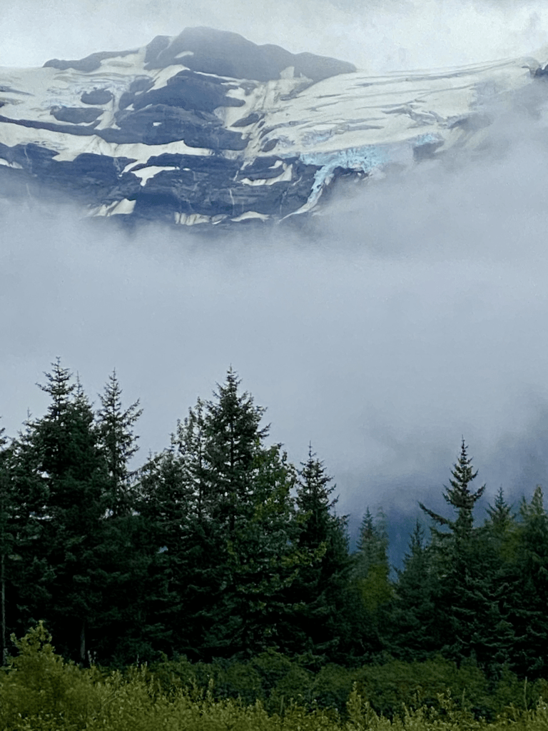
Below are the little icebergs calved from the glaciers surrounding Icy Bay

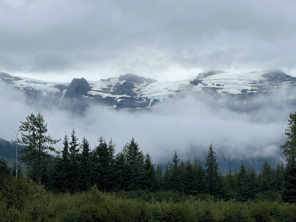
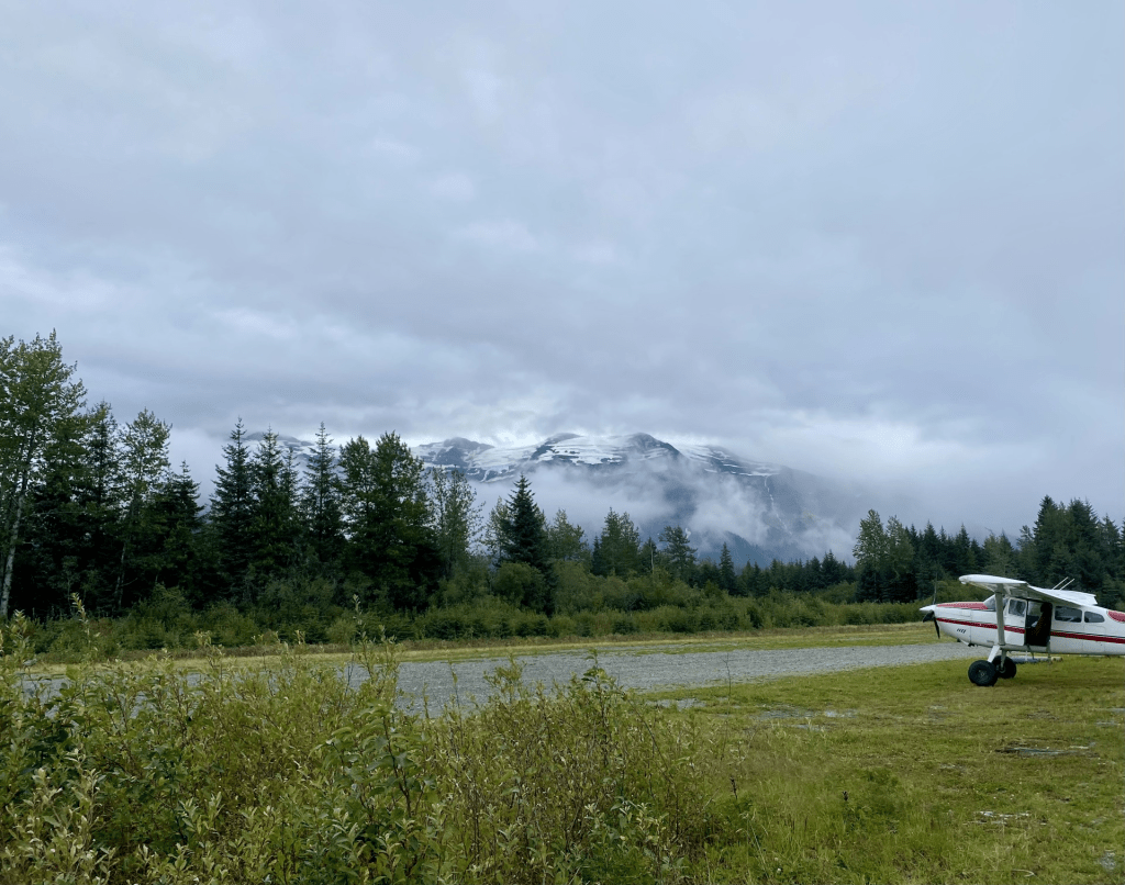
Below is looking up from our camp spot next to Icy Bay runway toward Guyot Glacier
Awesome little campspot


Leave a reply to fullybasement5ef0df7f87 Cancel reply