
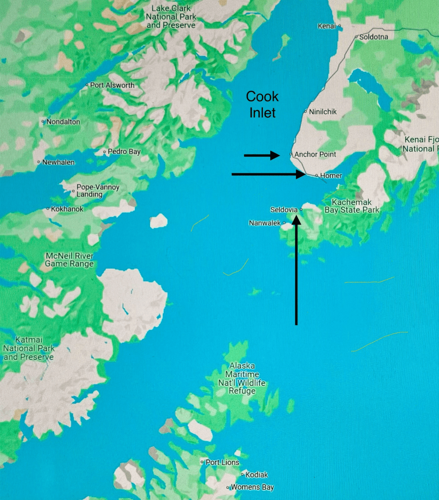
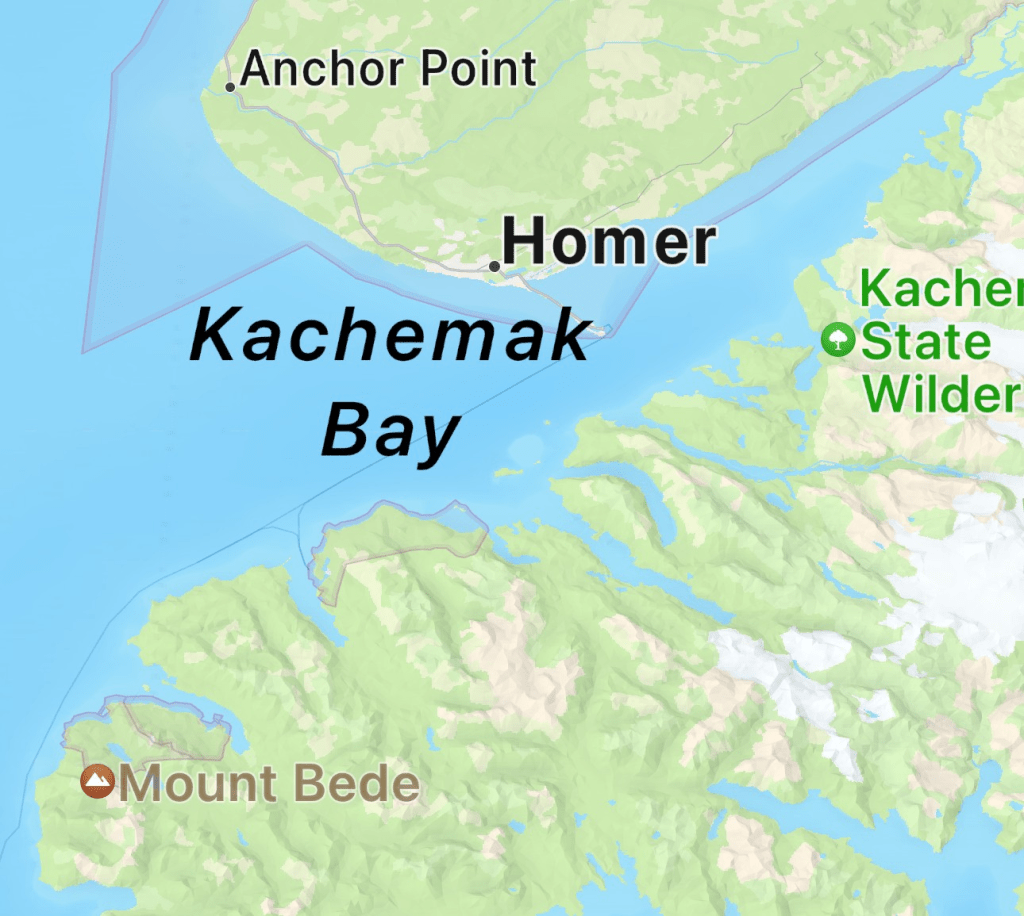
Nearing the tip of the Kenai Peninsula, is Anchor Point & Homer with Seldovia, Alaska just across the Kachemak Bay.
****************
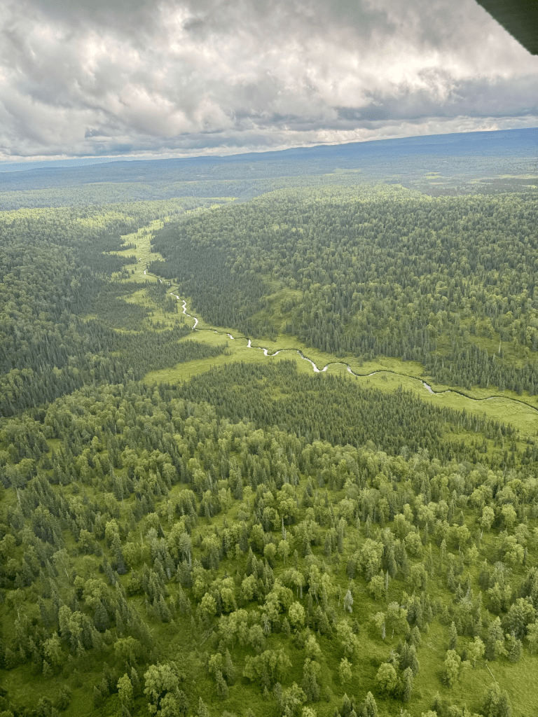
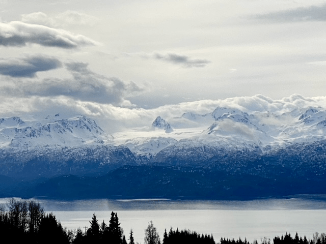
Below is the landscape overflying the Kenai Peninsula from Soldotna area to Homer & Seldovia

*********************
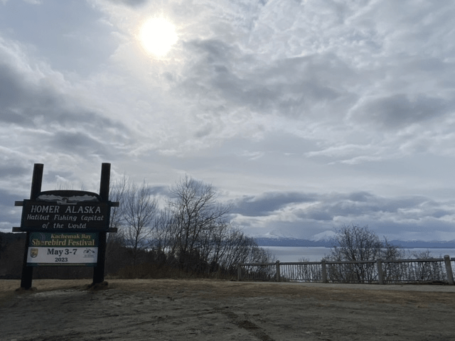
Homer, Alaska 59°38’33.00″ N -151°32’57.84″ W The Halibut Fishing Capital of the World
Homer is a quaint little town located approximately 225 miles southwest of Anchorage at the tip of the Kenai peninsula in the Kenai Peninsula Borough, Alaska. While rurally located, there are many businesses and a thriving fishing and tourism community here. Its geography is unique in that it is situated on the Kachemak Bay with a 4.5 mile long gravel bar, or spit, that extends into the bay.
The spit is an interesting geographical feature in that they form secondary to longshore drift at a cove’s headlands. This is a process where there is a deposition bar that forms where re-entrance of water occurs by longshore currents. The currents transport sediments such as clay, silt, shells, pebbles, etc. along and parallel to the coast line which is dependent on incoming wave direction angles. Oblique winds force the water to be compressed along the shoreline resulting in parallel water currents in relation to the coast line. The sediments are moved via the longshore currents within the surf zone. The beach sand also gets moved via this process secondary to swash and backwash of sea water, while the breaking surf pushes the water at an oblique angle the coast (swash) before gravity created the backwash (drainage of water perpendicularly back into the sea). The water ends up moving along the shore in a sawtooth pattern by the yards per day creating “beach drift” – the overall movement of sand parallel to the shoreline.
The above geographical phenomenon has resulted on the city of Homer along with the Army Corp of Engineers, the US Coast Guard, the AK Dept of Transportation and the Alaska Marine Highway systems collaborating to minimize the destruction and erosion of the spit as business and homes would be affected by erosional damage and the associated undermining of the spit beneath the Sterling Highway (the road over the spit). The city and infrastructure that relies on the spit include not only local business, homes and livelihoods, but other cargo and marine services that reach well beyond the geographic area of Homer.
The population of Homer is around 5,500. Its climate is much more mild than other parts of Alaska with climate moderated by the Pacific Ocean resulting in warmer winters and cooler summers when compared to interior Alaska. Its climate is considered a moderate subarctic Mediterranean climate with long and snowy winters but not really all that cold with averages in the dead of winter only being a little below freezing. Annual snowfall is approximately 50″ with about 25″ of rainfall annually due to the Chugach Mountains’ influences which provide shelter from the Gulf of Alaska. Summers are cool due to marine influences with relatively narrow temperature margins between mid 50’s and 70’s.
Dena’ina People: the Original Inhabitants of the Homer Region
The Homer region was originally inhabited by the Dena’ina people, who referred to the spit as “Uzintun” meaning “extends out into the distance”.
The Dena’ina name originates from dena meaning “person” and ina meaning “the people”. It is related to the autonym for the Southern Athabaskan Navajo people “Dine”. The Dena’ina are Alaskan Native Athabaskan people that are the original inhabitants of the southcentral region of Alaska (defined in this example as the region from Seldovia to Chickaloon to Talkeetna and Lime Village and Pedro Bay – quite an extensive area with their homeland being >41,00 square miles). The Dena’ina people arrived in southcentral Alaska between 1,000 – 1,500 years ago and were the only Alaskan Athabaskan coastal hunter gatherers with a matrilineal system (the tracing of family lineage via female lines with correlations within the social system where individuals are identified via their mother’s lineage having implications for inheritance, property and titles). The Iditarod Trail’s antecedents were the native trails of the Dena’ina and Deg Hit’an Athabaskan Native Alaskans and Inupiaq Inuit.
The Denaʼina are the only Northern Athabascan group to live near saltwater resulting in a mostly sedentary lifestyle when compared to other Northern Athabascans. The Denaʼina were organized in regional bands or Ht’ana (“people of a place”), which were composed of several villages or qayeh that contained multi-family dwellings called Nichił that were led by a qeshqa (“rich man” or “leader”) who American and Russian traders as well as clergy referred to as “chiefs.”
Shifting gears, in 1889, the Cook Inlet Coal Fields Company established coal mines in the region which in turn led to the town’s development. In the 1960’s hippies (known as “spit rats”) began to settle on the Homer Spit, and this influence is still evident today. Many of these folks became successful fishermen.
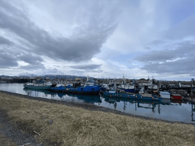
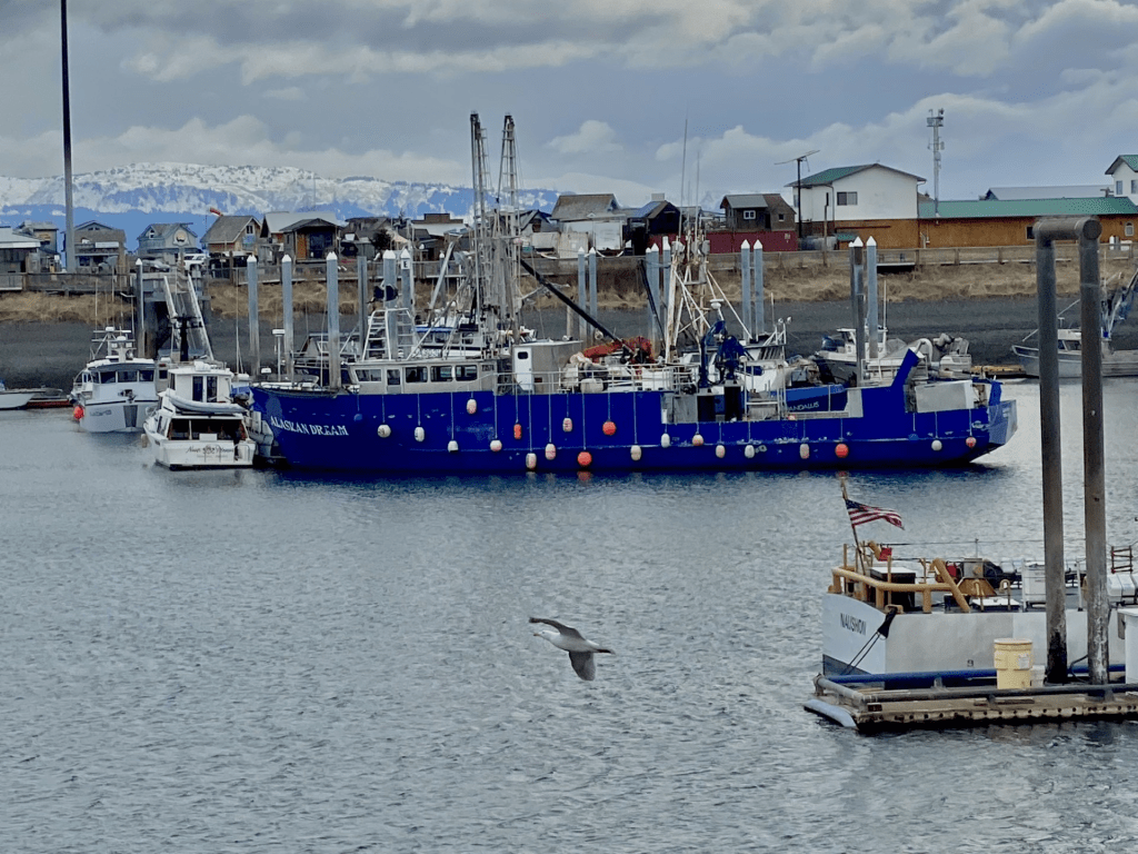
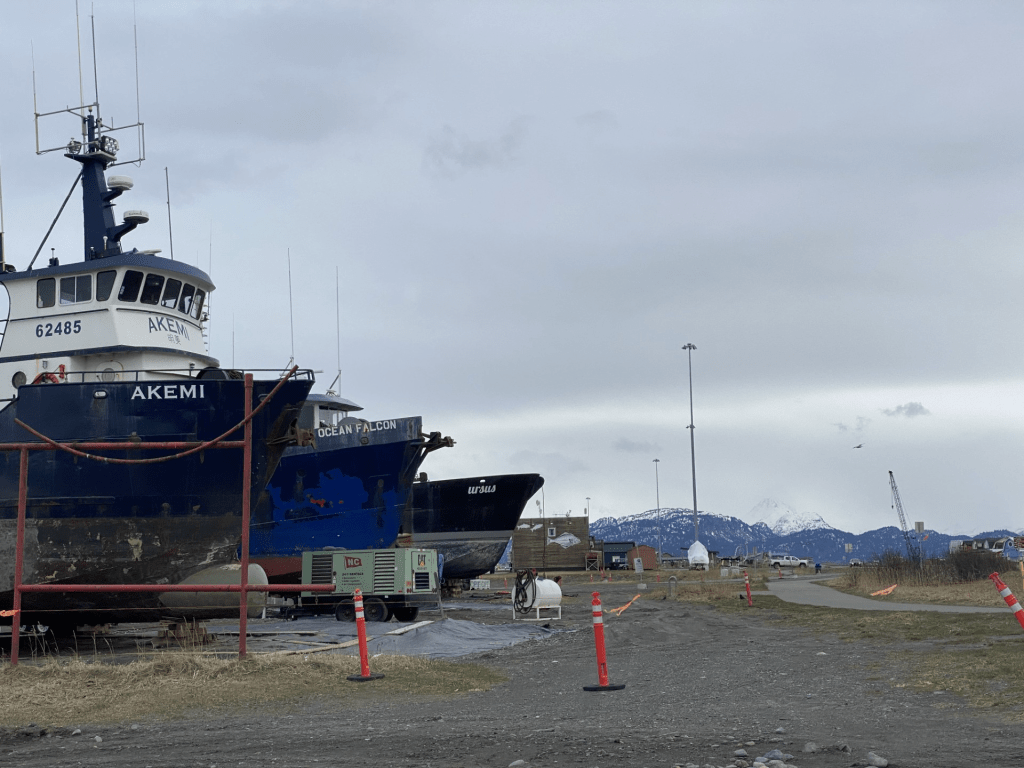
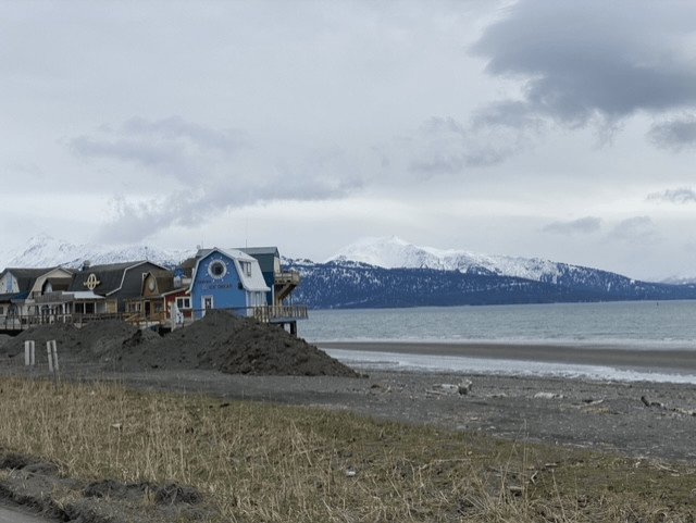
Below are views of Homer, its docks, the spit & Kachemak Bay.

Below are cute little touristy business of shops & restaurants along the Homer Spit. Homer has a thriving art community with many studios and galleries. The town hosts various markets and festivals throughout the year.
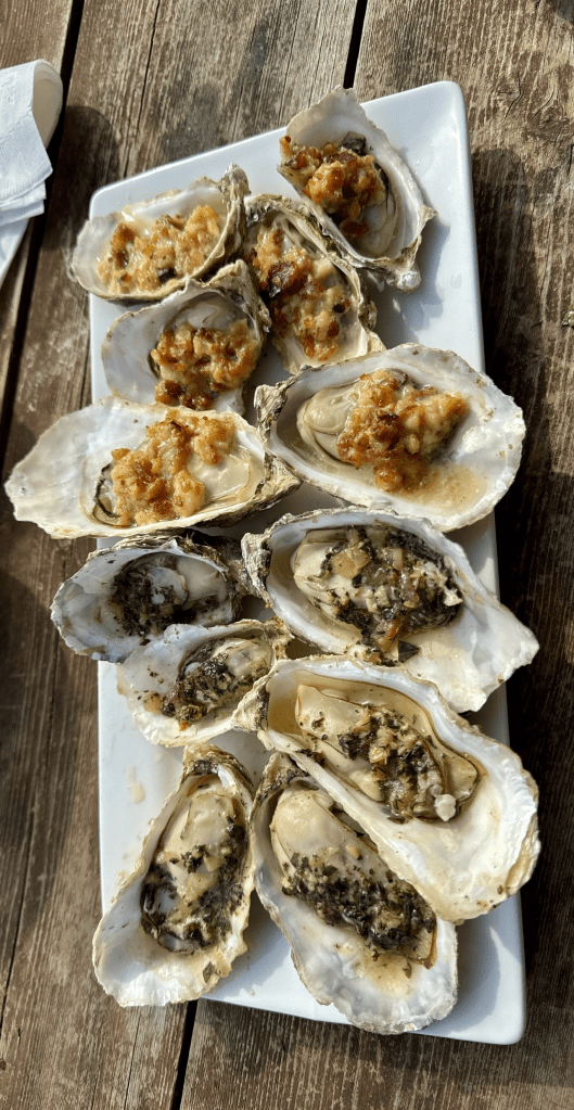
Some of the best oysters on the spit – baked with all kinds of goodness on top. Eaten on a windy afternoon on a picnic bench atop a high deck over the beach overlooking the bay. With a cold beer, of course.
Anchor Point, AK – a little town on the way the Homer

Anchor Point, Alaska – a little town on the Sterling Highway between Kenai and Homer that sits on the edge of the Cook Inlet and is the most westerly point in North America that is still accessible by the road system. This quaint little town got its name from Captain James Cook’s ship, the HMS Resolution, who lost a large anchor while attempting to sail north against strong tidal waters in the summer of 1778; this event led to the name Anchor Point.
There is incredible scenery around Anchor Point – especially across the Cook Inlet looking toward Redoubt, Augustine, Douglas and Iliamna volcanoes near Lake Clark and Katmai National Parks.
The town has cute little tackle shops, restaurants, art galleries, an antique shop, a museum, a few bars and lodging. In addition to incredible fishing for Dolly Varden, silver salmon and steelhead trout, there are plenty of opportunities for wildlife viewing, marine tours, dog sledding, and flightseeing. Anchor Point beach is an awesome spot to camp, have a fire, and see plenty of bald eagles and shore birds. There is easy access to the Cook Inlet for Halibut fishing in the deep waters surrounding the area.
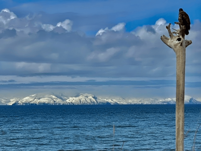
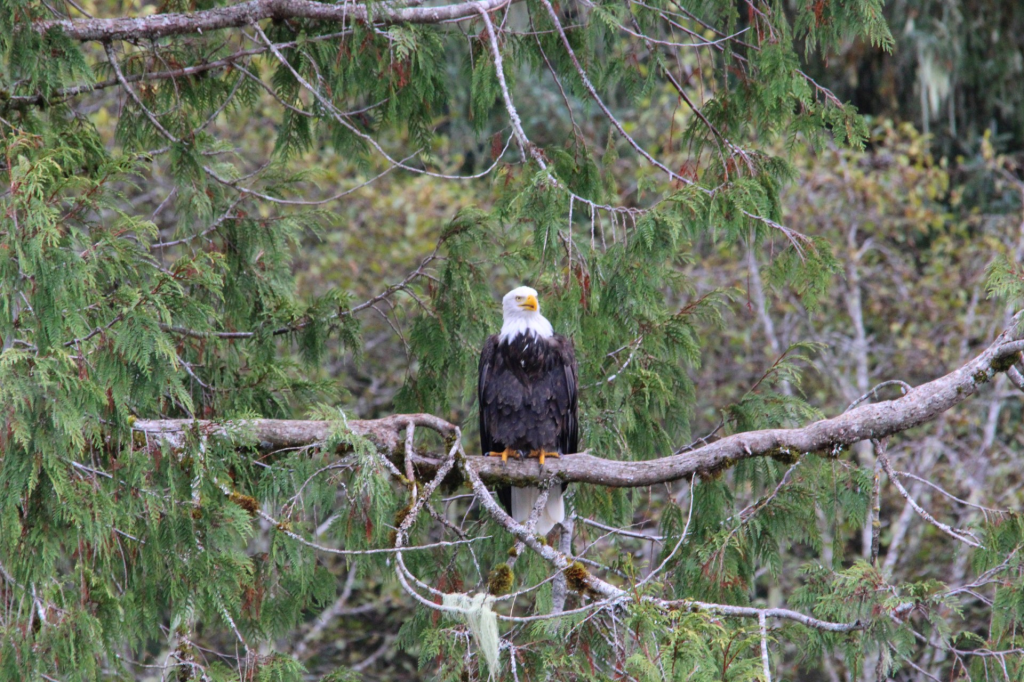
Below: taken from an Anchor Point beach overlooking the Cook Inlet to the west. A beautiful eagle keeps watch nearby. He was magnificent and seemed to not care at all that I was there sharing his view. In those mountain ranges above are Iliamna, Augustine, Douglas and Redoubt volcanoes as well as Katmai National park to the southwest and Lake Clark National Park to the northeast.
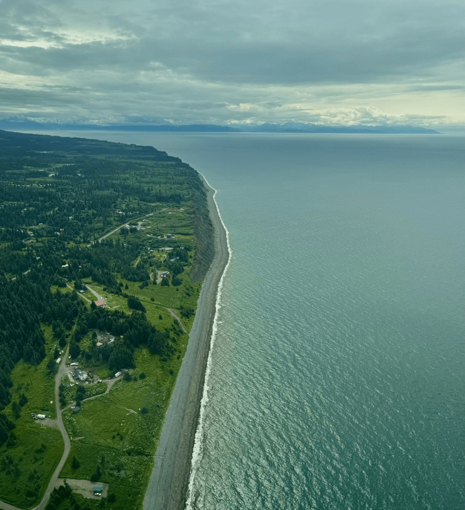
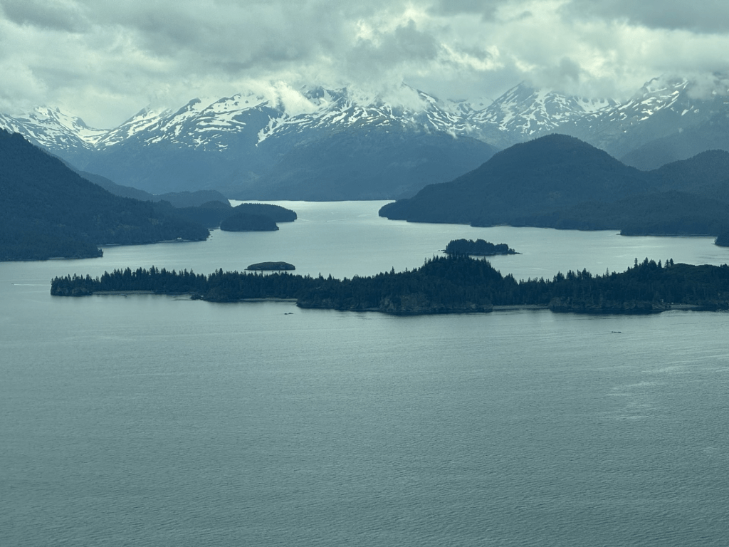
Below: overflying the beach from Anchor Point wrapping around toward Homer & Seldovia
Wildlife Corner
The Great Alaskan Moose (Alces alces)
`(okay, its not called “the great Alaskan Moose” but its pretty a pretty commanding appearing animal and deserving of that title in my opinion)
The large and gangly Alaskan moose is one of my favorite sites in this beautiful state! It is the largest member of the deer family and the only species in the genus Alces. They range in size from 800 pounds (females) to 1,600 pounds (males) and stand up to 6 feet tall on their spindly and awkward appearing legs.
Moose can be found all across the North American forests, Europe and Russia. In Alaska, they range from the Unuk River in Southeast AK to the Colville River on the Arctic Slope with particular abundance along timberline plateaus, along major rivers throughout the Interior and Southcentral Alaska, and in burned areas where regeneration with birch, willow and aspen stands abound. Most moose make seasonal movements to rutting, mating, calving and wintering grounds moving from several miles up to 60 per day.
There are approximately 175,000 to 200,000 moose widely distributed throughout the state of Alaska. In southeastern Alaska, moose are found in limited areas and are mostly absent from the major southeastern islands. The majority of the moose in southern and southeastern Alaska are concentrated in the Unuk River drainage and are believed to be the subspecies Alces alces andersonii, versus Alces alces gigas, the largest of the moose subspecies, which is found throughout the rest of Alaska north of the Stikine River. They are also reported to be able to swim the 6 miles across Clarence Strait to Prince of Wales – a feat that is just impressive given their body habitus.
They range in colors from almost black to deep chocolate browns to golden and red hues with newborn and younger calves being reddish to light rust shades. In just one summer, the calves have shed their initial newborn coats and replaced it with a coat similar in color and texture to their adult counterparts.
Males carry an impressive rack of unmistakable antlers forming within the first year of life and are produced annually each summer thereafter with the largest antler sizes developing my 10-12 years of age, however they can reach trophy size as young as 6 years of age. They rarely live beyond 16-20 years.
I ran across this cute little yearling that appears to be in great shape with a shiny coat and plenty of forage


As in many other animal species, moose growth patterns, reproductive maturity age, and offspring production are closely associated with range conditions. Males engage in the “rut” by late Sept – Oct where they joust via pushing their antlers together with serious battles being rare and only minor injuries occurring. The “winner” gets to mate with the females. I am guessing the loser just stays home and plays video games.
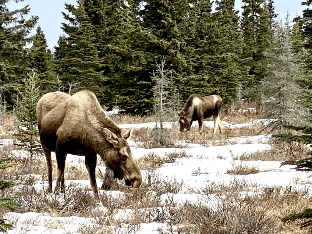
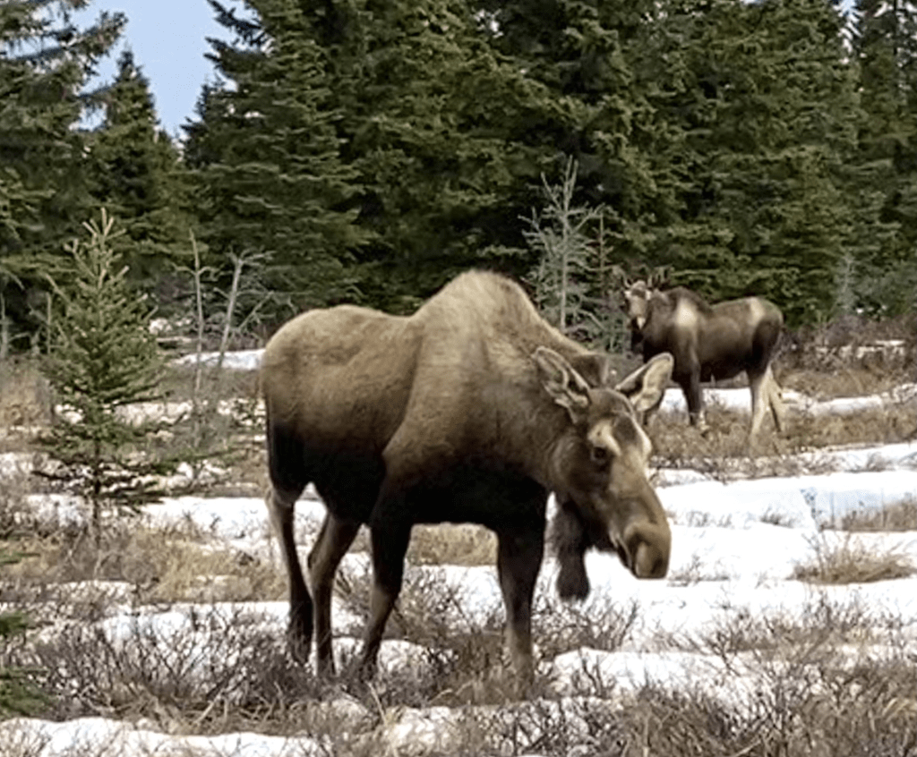
Moose cow with her two offspring
Moose are herbivores with diets consisting typically of birch, willow, aspen, sedges, pond weeds, grasses and twigs. They often will establish “browse lines” approximately 6-8 feet above the ground.
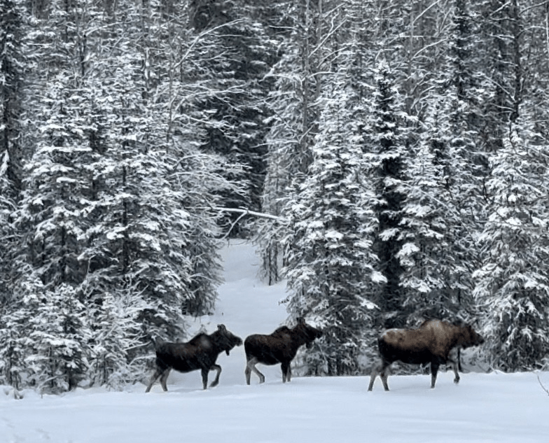
Moose grazing and hanging out in Anchor Point
**********************
Bald Eagle (Haliaeetus leucocephalus)

Perhaps one of the most iconic raptors in America, the Bald Eagle, Haliaeetus leucocephalus, is both regal and conspicuous with its characteristic white head contrasted with its specialized, curved yellow beak. Its name originates from the appearance of the adults’ heads – bald referring to having white on the head (rather than “hairless”) from the older English usage of the term. The old English etymology originated from American colonists when “bald” did not mean hairless, but white.
The characteristic white head of the adult bald eagle develops at about 5 years of age along with its characteristic white tail. Immature, or juvenile bald eagles, remain a mottled brownish-white in color until they are about 5 years old at which time their darker black beaks also shift lighter to a vibrant yellow to orange yellow color. Juvenile bald eagles can be easily mistaken for golden eagles (Aquila chrysaetos) in regions such as Alaska where they coexist, but can be differentiated from each other by the bald eagles featherless legs and white lining on the their leading wing edges.
The bald eagle is the largest bird of prey in Alaska, and found in higher numbers in Alaska than in any other state in the the United States with the Alaska population estimated at approximately 30,000 individuals. Females are typically larger than their male counterparts with over all male and female size ranging from 8-14 pounds with a huge wing span up to 7.5 feet!
They are found frequently along coastlines, interior Alaskan rivers and lakes, as well as offshore islands. Most winter in the southern regions of Alaska with smaller populations leaving the state during these colder months. Near Haines, Alaska in the Chilcat Valley, each fall there is the largest congregation of these magnificent raptors numbering in the 3,000’s to feed on the spawning salmon runs. [Regarding this region in Alaska – in 1972, the Alaska State Legislature designated a stretch of the Chilkat River as critical bald eagle habitat to ensure their protection given these large numbers that gather each winter. Later, in 1982, a section of the adjacent region was established as the Alaska Chilkat Bald Eagle Preserve].
As expected, their diet consists mainly of fish including salmon, herring. and pollack in coastal regions with more salmon based diets in the interior parts of the state. They are also known to consume other sea life including clams, crabs, other water fowl and carrion (dead flesh). Small mammals are also on the menu, of course, for this bird of prey. Regarding their prey, a common misconception if that these birds cannot release their prey at times (as if some involuntary mechanism is at work) resulting in them carrying it with laboriously “rowing” their wings, or seeming to struggle to carry heavier prey; however, the eagle’s grasp with their talons is purely voluntary and these aforementioned behaviors observed are really just the eagle’s tenaciousness in hanging onto valuable food that can sometimes be too heavy to lift resulting in them getting the meal to shore rather than losing it.
Another common misconception is that these raptors carry off house pets such as dogs and cats. This is really unlikely in that they are only able to lift 3-4 pounds, and maybe a little more than that if they are swooping downward to catch their prey. The laws of aerodynamics still prevail regardless of the bird type (or your political beliefs), and their wings must be able to support their own body weight PLUS the additional payload of the said object/prey – this results in about a 4 pound payload at best. This does vary under some circumstances. For example, take an airplane – its lift depends not only on its wing size but its airspeed as well. So translate that to an eagle/bird flying in a fast swoop to catch its prey – the increased momentum and speed do result in its increased ability to carry more weight but this does not translate into house pets routinely being carried off into the wild blue yonder. In summary, the cat/dog would have to be pretty small – not that they don’t exist, but this just isn’t a common phenomenon albeit it makes for great stories. And I digressed AGAIN but it was such an easy airplane segue way that I simply could not resist.
The highest nesting densities occur on the islands of Southeast Alaska where bald eagles usually nest in old-growth timber along saltwater shorelines and mainland rivers. Eagles in Southcentral Alaska nest in old cottonwood trees near water.
Bald eagles build their nests in April with both males and females contributing to its construction. The nests are built close to water with clear views of the surrounding area and with sparse overhead cover from trees above the nest. In late April, 2-3 eggs are laid over several days with an incubation period over the next 35 days or so before the chicks hatch. Sibling rivalry is common with younger, weaker chicks being starved or killed while the chicks that survive remaining in the the nest until they are approximately 75 days old before leaving on their own.
From a historical and protection standpoint, in 1917 the Alaska Territorial Legislature imposed a bounty on eagles in response to salmon industry and coastal fox farmers’ claims that eagle predation was creating too much competition for their livelihoods. These claims were discredited but the bounties remained in effect for 36 years resulting in killing over 120 thousand eagles before the bounty was removed in 1953. Eventually the Bald Eagle Protection Act was passed making it illegal to possess or kill an eagle or to have any part of one including its feathers.
Meanwhile, in the lower 48, eagles were being eliminated to the extend of becoming endangered via illegal shooting, pesticides, poisoning, and habitat destruction. Through protection acts aimed at water quality and habitat improvement, their numbers have recovered and in 2007 they were removed from the endangered and threatened species list, and are no longer protected under the Endangered Species Act. The Bald and Golder Eagle Protection Act, however, still protects them currently including protecting them from being taken from the wild and/or disturbing them/their habitats. There are further circumstances that the National Bald Eagle Management Guidelines govern that apply to eagle activities on private and public lands aimed at minimizing human activities on these raptors.
**********************
It would be amiss not to cover the Kachemak Bay and the Grewingk Glacier that overlooks the bay when covering the Homer region.
Kachemak Bay is a 40 mile long arm of the Cook Inlet on the Southwestern side of the Kenai Peninsula. The towns of Homer, Halibut Cove, Nanwalek, Port Graham and Katchemak City are all located alone the bay. Additionally, there are several Russian settlements in the Fox River region of the bay – Voznesenka, Razdolna and Kachemak Selo – here “Old Believers” or “Old Ritualists” reside whom are Eastern Orthodox Christians who have maintained ritual and worship practices of the Russian Orthodox Christians as they were prior to the reforms of Patriarch Nikon of Moscow between 1652 and 1666.
The name, Kachemak Bay comes from the Alutiiq peoples word for “Smokey Bay” that describes the smoldering coal seams that used to fill the bay with smoke. A coal seam fire is a burning of an outcrop/underground coal seam that has smoldering combustion due to limited oxygen availability. These fires date back several million years, and are the most persistent fires on earth, some burning for thousands of years, secondary to thermal insulation and the earth’s crust preventing snow/rain contributing to their extinguishment. They can be self-igniting due to self-heating of low-temperature oxidation, wildfires, lightening, and arson in some cases. These coal seam fires have been changing the lithosphere of the earth’s crust slowly for many years along with associated atmospheric changes, but the pace of these slow changes has been accelerated in recent years due to mining.
Kachemak Bay includes a state park that was the first in Alaska and is without road access – the only means to get there is via boat or airplane. It is also home to the Kachemak Bay Estuarine Research Reserve, an active research and education site. The bay has a high level of biologic activity secondary to its water circulatory patterns fostering thriving shellfish larvae and nutrient populations and driving currents of nutrients into the bay and back out to the ocean resulting in fertile waters for both flora and fauna associated with the area. The tides in the bay are extreme with a mean vertical difference of 15.5 feet.
Year round, both shellfish and fish are abundant, while waterfowl and shorebirds thrive in abundance all but in the winter season. Waterbirds and marine mammals, including porpoise, otters, seals and whales, remain in the bay year round. The Kachemak Bay serves as a winter home for 90% of the waterfowl and seabird populations of the lower Cook Inlet. In warmer months, it is not uncommon to see moose, coyotes, and bear in the area.
Grewingk Glacier & Kachemak Bay below
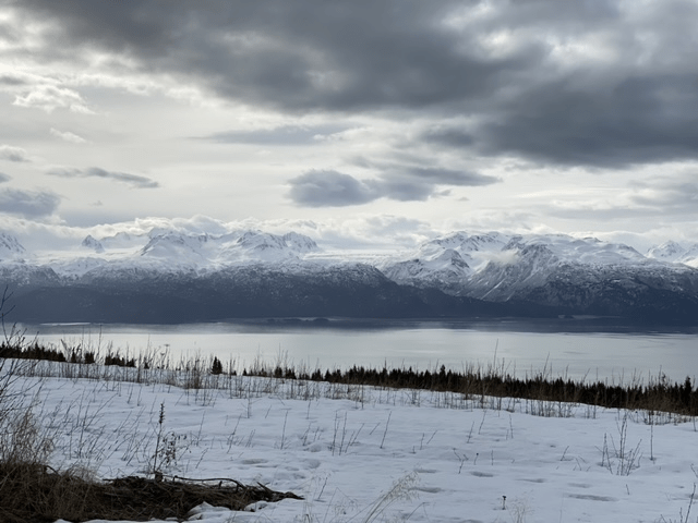

Grewingk glacier is a 13 mile long glacier in the Kenai Mountains overlooking the Kachemak Bay just about 15 miles from Homer, AK. It begins and terminates at 59°34′51″N 150°57′01″W and 59°36′11″N 151°07′39″W, respectively. The glacier was named for a Baltic German geologist in 1880, Constantin Grewingk, and offers a pristine hiking trail that is remote and stunningly beautiful. The hike to the glacier includes not only glacial aspects but a dense rainforest and abundant wildlife. You get to the trail via a water taxi from Homer, or of you have access to a float plane, its even better!
Seldovia, Alaska
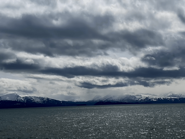
Below: Waters on the flight from Homer to Seldovia
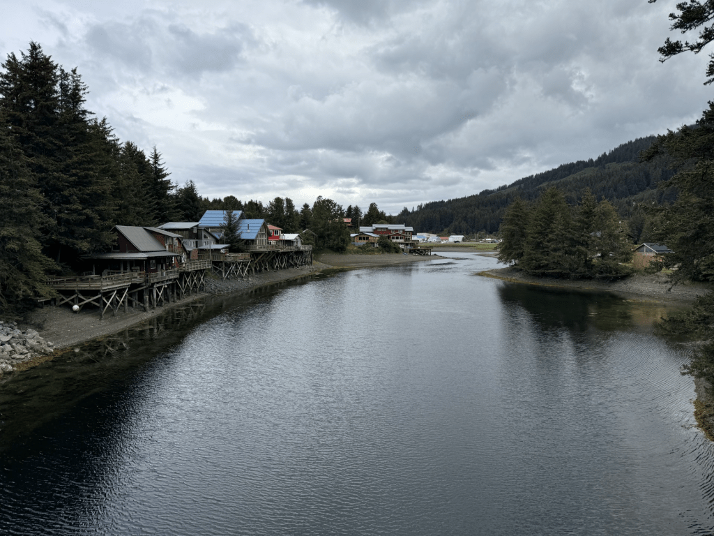
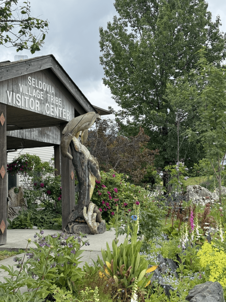
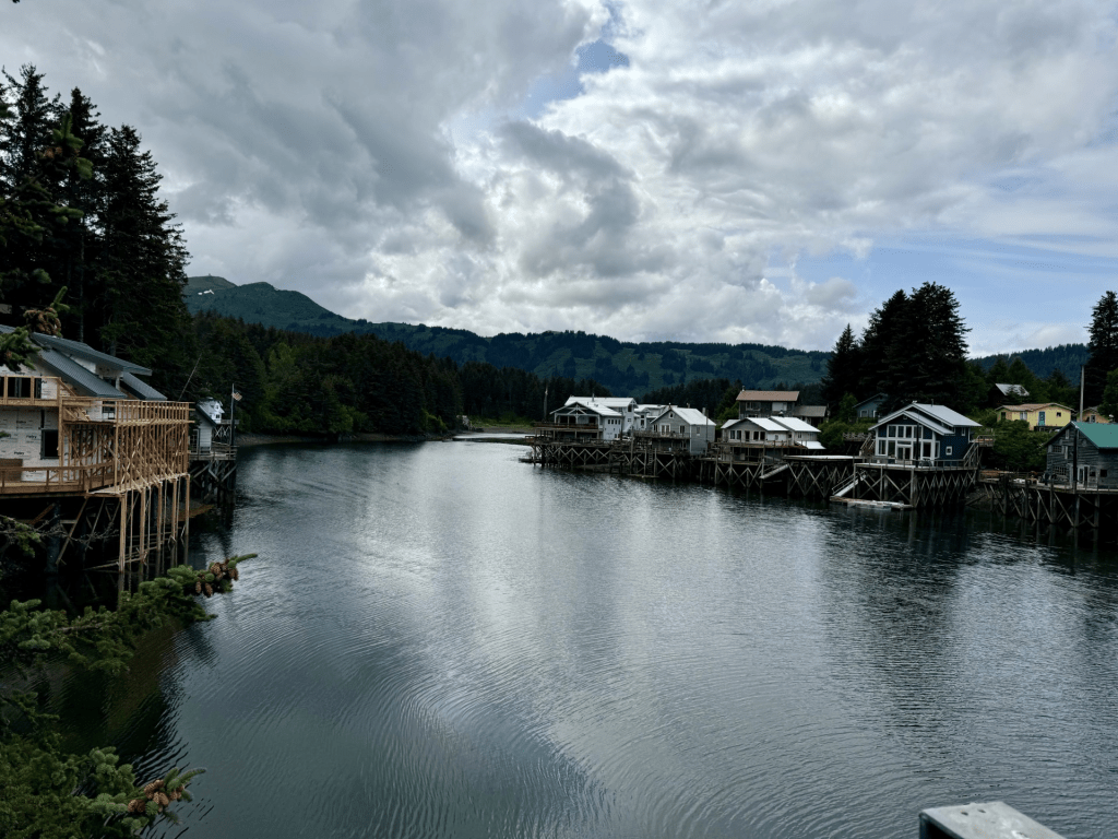
Images of Seldovia below: another welcoming, quaint fishing village with a deep cultural Native roots that I love to embrace
Seldovia Airport (SOV) below
The airport is a public use 1,845′ gravel strip approximately 15 miles from Homer across the blue water arm of the North Pacific Ocean’s Gulf of Alaska just outside of the entrance to Kachemak Bay. The airport is a public use strip within an easy walking distance (~ 1/2 mile) to the village where you can enjoy a quaint stroll around the town, the marina and the very best clam chowder I have ever had. Granted, I am from New Orleans, and clams ain’t our thing so I am no expert; but this was “slap yo mamma” good!


The BEAUTIFUL town of Seldovia (Alutiiq – Angagkitaqnuuq; Dena’ina – Angidahtnu) is located along the Kachemak Bay southwest of Homer, AK. Its original name, the Russian name Seldevoy, translates to “Herring Bay” reflecting the significant herring population present in the region prior to overfishing in the early 20th century. There are no roads to this sweet little gem, and only accessible via plane or boat.
The Indigenous people of Seldovia comprise a quarter of the population of Seldovia and are are of Aleut, Alutiiq (Sugpiaq) Eskimo and Dena’ina Athabaskan ancestry. Around 1788 a Russian fur trade post was established in Seldovia by hunting parties associated with the Russian-American Company (this was a state sponsored chartered company by Paul I of Russia with the mission of establishing new settlements in Russian America where trade with Indigenous people was conducted along with the expansion of colonialization). There is little definitive archeological evidence of humans in Seldovia prior to the 1800s; however, the it is purported that the early Russian St. Nicholas Orthodox Church was built atop of an aboriginal Inuit village site.
The Fur Rush comprised Russian traders who sailed along the coast of the Artic and arrived in the Aleutian Islands in the 1740s. The Russian influence later extended to the Seldovia region as sea otters were found in abundance. Later, Americans moved into the region to exploit the otter and Native communities were forced into service for the fur companies. Men were forced to leave their homes in search of furs resulting in Native families being separated and food shortages ensuing. The Russian Orthodox missionaries held tremendous influence over the Indigenous people but also held respect for some of the native cultural practices and traditions as the introduced their Orthodox faith.
Russian Orthodox Missionaries exerted tremendous influence over Native people but they also showed respect for the culture and traditions as they introduced the Orthodox faith. The missionaries took the time to learn the Aleut language and assisted the Aleuts in documenting a record of their language and culture. This resulted in the Orthodox faith being blended with traditional Aleut cultural belief and practices and was integral to the Seldovian congregation’s daily lives.
Historically, Seldovia served at a stopping point for steamers from the lower 48 travelling to the gold fields in the upper Cook Inlet. Railroad construction contributed to the development of Seldovia as well along with aforementioned herring fishing that resulted in both salmon and herring canneries.
Seldovias largest and most significant economic period of outstanding economic growth or expansion began when the Seldovia Salmon Company was built in the early 1900s. At the pinnacle of Seldovia’s canning industry, it produced not only herring and salmon, but also shrimp, crab, and halibut. The herring canneries, unfortunately, ended up causing high concentrations of rotting fish in the area which led to the killing of vegetation needed for the herring to spawn. This culminated in the closure of the herring canneries by the 1930’s. The canneries that remained in production were eventually closed once the Good Friday Earthquake of 1964 struck but not before families were created between the men who came to Seldovia to work them and the native women that resided there. These established families are still central to the town.
Additionally, mining and logging have been a part of the town’s economic past with coal mining in Homer beginning in 1899 providing employment for nearby Seldovians via enabling them to create livelihoods from supplying homes, businesses, and canneries coal. Additionally, nearby Red Mountain (southeast of Seldovia) has chromium ore deposits that supported mining operations, but these mining operations were eventually stopped as a result of a decline in chromium ore demand in the 40’s and 50’s. Last, logging had been in operation for years in the area with a major sawmill eventually catching fire being destroyed 1920s. Other sawmills were in operation in the 1960’s and 1970’s however eventually Seldovia Native Association sold its logging rights because of trees killed by salvage beetles.
Although the above factors have shaped the Seldovian community throughout the years, the Seldovia Village Tribe continues to pride itself on their cultural identity that reflects elder wisdom, commitment to youth, and determined self-sufficiency. Seals have been harvested by the native people of this area for meat, oil and fur, while salmon and halibut have provided the main staple for the people of Seldovia. As in many native tribes, native stories and legends of the Indigenous people of Seldovia have revolved around bald eagles. The Horned Puffin has provided food and clothing with the feathered side worn inward for warmth and the skin creating a tough barrier. Bears area also an important part of the native culture of this area providing food, clothing and blankets for the long Alaskan winter.
In summary, Seldovia has fostered many industries including fisheries related commerce, berry picking, fox farming, mining and logging. Currently, charted boats continue to bring sport fisherman to the region. Its tidal movements are among the most severe in North America and have been compared to those of the Bay of Fundy, and this undoubtedly shapes those activities.
Until road system developments in Alaska, Seldovia was a vital initial stop for ships from Kodiak, Seward and other points outside of the Cook Inlet. The town’s population has dwindled over the years with it once being home to over 200 residents and in 2020 has a population of about 200.
Quiet homes line the waters in the Sedovia village.

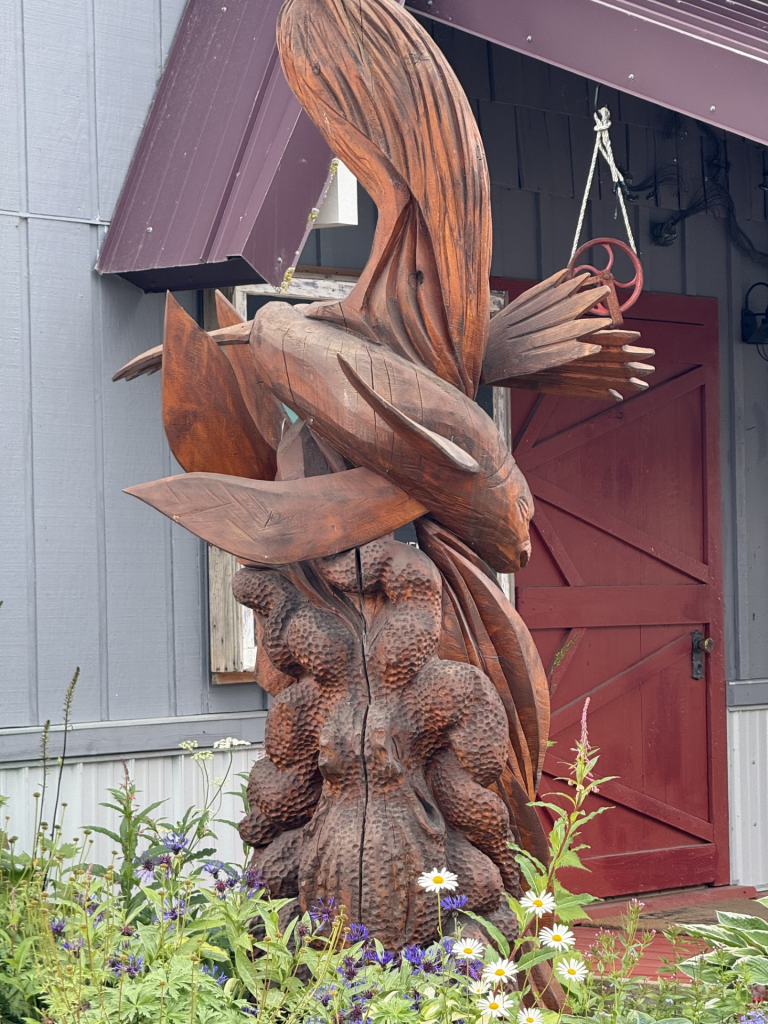
Carving of a freaky anglerfish (order Lophiiformes) in the Seldovia Village. These fish are deep water fish that are truly freaky in their appearance and bioluminescence that they use to attract prey on the deep ocean. They use their “lures” via waving them back and forth in a similar manner as fly fishermen use their imitation flies. I am not sure of the significance of this carving in the middle of town and none of the locals I talked to had any information about why its there. There is an annual chain sawing competition in Seldovia, but not sure how that related (if it even does) to this carving. Nonetheless – its cool.

Leave a comment