
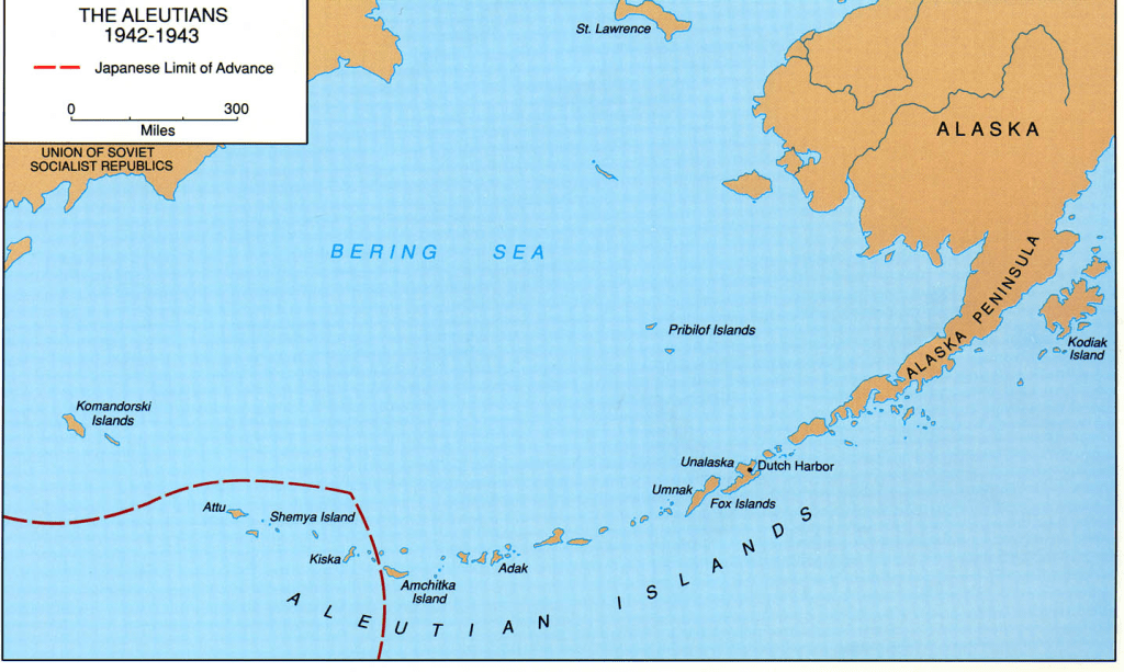
The Aleutian Chain, Shumagin Islands & Sand Point, Alaska
The Aleutian Islands, or Aleut Islands, are an island chain comprised of 14 main volcanic islands with 55 smaller islands. All but the far western portion of the island chain are owned by the US and the state of Alaska with the far western portion being under Russian control (known as the Commander Islands). The Aleutian Islands form an arch of islands extending from the southwestern part of mainland Alaska, westward for approximately 1,200 miles between the Bering Sea and the Northern Pacific Ocean. Its westernmost island is the historically famous, Attu Island, which is west of the International Date Line. With its 57 volcanoes, the Aleutian Island chain forms the northernmost portion of the Pacific Ring of Fire and is considered the most isolated region on the northern Pacific.
The Islands of the Aleutian Chain, east to west are the Fox Islands (comprised of Unimak, Akutan, Unalaska, and Umnak Islands); Island of 4 Mountains (comprised of Yunaska and Chuginadak Islands); Andreanof Islands (comprised of Adak, Atka, Amlia, Seguam, Kanaga, and Tanaga Islands); the Rat Islands (Kiska and Amchitka Islands); the Near Islands (Attu and Agattu Islands); the Semichi Islands (Alaid, Nizki and Shemya Islands); and the Commender Islands (Bering and Medny Islands).

Flight over the Alaskan Peninsula – icy spires and clouds near Katmai National Park & Preserve
From a military historical standpoint, there were battles during WWII that took place in the Aleutian’s with the Japanese occupations of Kiska, and perhaps more famously, Attu Island. In 1942 – these were one of only two invasions of the United States during WWII (the second being the Philippines, Guam, and Wake Atoll/Pacific territories of the US).
For those interested in geological facts regarding the region, the movement between the North American and Kula plates along the Bering Shelf ceased in the early Eocene era. The ocean floor north of the Aleutian arc of islands, the Aleutian Arc, is the remnants of the Kula Plate before its entrapment when the island arc formed from the subduction of the Pacific plate beneath the North American plate. The arc plates are like blocks, rotated clockwise and formed of volcanic, marine sedimentary, sedimentary and igneous rock.
The majority of these islands are of volcanic origin, with numerous volcanic cones both active and inactive. Most of the islands’ coasts are surf worn rocks with dangerous approaches and immediate land rises from sea-level coasts to the adjacent steep mountains reaching elevations of 6,200 feet. You can see steam venting from some of the volcanic cones on clear days making for a dramatic scene with their snow capped cones. Perhaps you recall a recent event in 2017 where near the town of Unalaska there was an explosive eruption launching ice and ash particles 30,000 feet upward resulting in air traffic being grounded for some time. While these areas remain inhabitable, they are clearly active and alive beneath the surface.

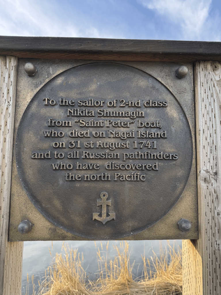
Sand Point, Alaska and the Shumagin Islands
The Shumagin Islands are comprised of a cluster of 20 islands in the eastern Aleutian Chain with Popov, Unga, Korovin and Nagai Islands being the largest.
Sand Point, a small fishing village on Popov Island, lies southwest of mainland Alaska and Kodiak Island, between the Bering Sea and the Northern Pacific Ocean and is approximately 10 miles by 5 miles in size with an elevation from sea level extending to 1550 feet.


Sand Point is comprised of approximately 450 residents (depending on time of year) and home to the Aleutian Island Chain’s largest commercial fishing fleet, driving the local economy. Trident and Peter Pan Seafoods both operate from Sand Point with fish processing plants for Pacific cod, salmon, herring, halibut and pollock. The Sand Point harbor was revamped by the Borough and the Army Corp of Engineers in 2014 and can currently hold >150 vessels in permanent slips and those for transients.
The town was founded in 1898 via a San Francisco cod fishing company with Aleuts and Scandinavians as its early residents. In the early 1900s, gold mining drove the economy briefly before fishing dominated the town. Approximately half of the inhabitants of Sand Point are of Aleut descent (predominately from the Qagan Tayagungin tribe) with the remaining portion of the population being mixed with seasonal and year-round folks from black, white, Asian, and Latino origins.
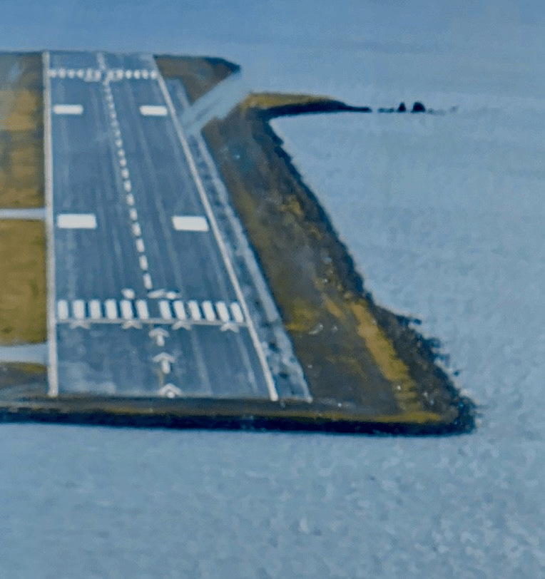
The only way into Sand Point is via plane or boat as it is off of the road system. Sand Point has 1 airport with a 5,200′ paved and lighted runway with weekly flights from various outfitters. The town is notorious for its subpolar, oceanic climate (screaming high winds and squalling weather) making flights into and out of Sand Point exciting and a religious experience! The winds and weather patterns are a result of maritime influences of cold air flowing from over the Bering Sea meeting warmer air from over the Japan current. Temps range −9 to 76 °F with an average snowfall of 52 inches with an average rainfall of 33 inches.
The town offers 2 small (and pricey due to the cost of getting goods there) grocery stores; fuel; a school (grades K-12); a health clinic with limited emergency services; a small Baptist and Russian Orthodox church; and last but not least – a local tavern.
Sand Point Runway
History of the People
The first contact between the Aleuts and Westerners was in approximately 1743 when Russian fur traders began arriving to the region. Archeological data supports that the Aleut people had comprehensive knowledge of sea mammal anatomy that was significantly more comprehensive than similar knowledge in other Alaska Native tribes. This was exemplified, in part, by their mummification practices of the dead where they cared for the mummies different that other tribes and also performed some successful surgical procedures. The Aleuts also utilized medical plant from the land more than other Alaskan tribes. Traditional healers are still active within the tribe, although Western medicine has predominated over the medical care of the people living here.
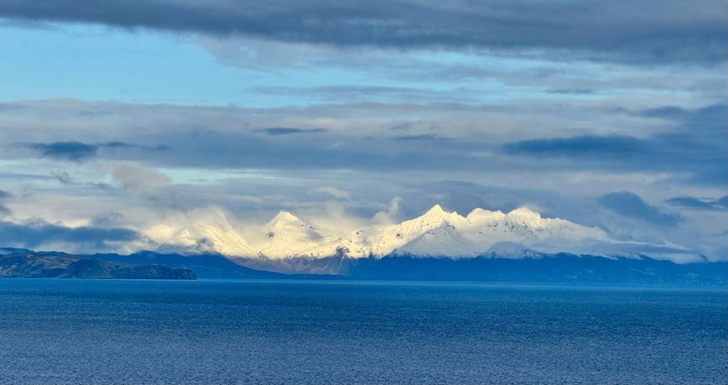
Looking toward the Alaskan peninsula from Popov Island
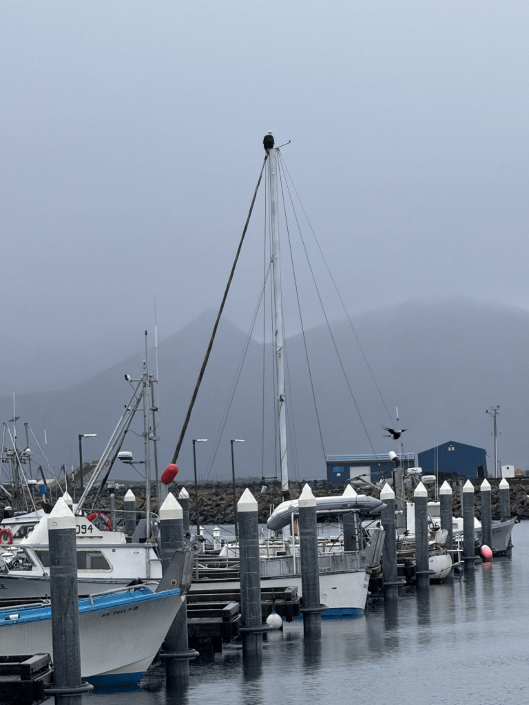
Scenes around Sand Point Harbor


Ptarmigan in their winter white outfits (these birds change to white in the winter – see prior post for more information about these little birds)


Leave a comment